Hiking Breckenridge, Colorado
Hiking and mountain biking trails are to Breckenridge like coffee shops are to Seattle. They are basically on every corner, and in fact many of them you don’t even need a car for. Some of them you can walk to, such as Burro Trail or Sawmill Trail (both located just off Breckenridge ski runs), and others you can ride the local free shuttle to, such as Boreas Pass, which is arguably Breckenridge’s most beautiful drive. So today I’m coming at you with a hiking Breckenridge itinerary if you have more than just a couple days and want to hit some of the best hiking trails in Breckenridge, Colorado. So let’s get to it.
Day 1
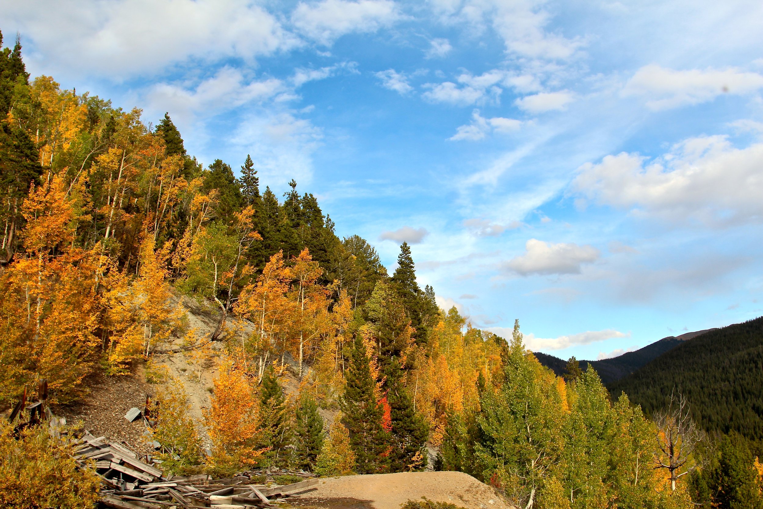
Amidst so much of the Old West, I momentarily felt like Roy O’Bannon (better known as Owen Wilson in the film Shanghai Noon), stumbling upon old mines while locomotives mountain bicycles raced by me. Driving down Wellington Road (just off Main Street in Breckenridge) I found a number of trails, most of which you could even ride a bicycle to from town. I went up the Reiling Gold Dredge, which weaved through thick forests, past old mines, and provided panoramic views of both the town of Breckenridge and Breckenridge Ski Resort. And that’s without mentioning the beautiful fall colors that were more evident here than in Breckenridge itself. Also nearby was Reiling Dredge, where you see the remnants of the dredge that sank in the pond in the early 1900s. This made for a great, relatively easy first hike as I acclimated to the 10,000-foot elevation.
Day 2
Waking up feeling good and without feeling any noticeable effects of the altitude, it was time to take it next level for hiking around Breckenridge. I drove the 10 miles to nearby Hoosier Pass, which in the fall is among the most beautiful places to see the fall foliage in Breckenridge (especially if you keep going just beyond the summit along Highway 9).

From the parking area, there were a number of hiking trails, some of which overlook lakes, others of which weave through forest, and others that go to nearby summits, including Hoosier Ridge and North Star, both of which are more than 13,000 feet. I hiked on a couple of the easier trails, which hovered between 12,000 and 13,000 feet, and included views of nearby lakes and the 13,000-foot peaks.
These hikes were all relatively easy to moderate hikes for the common hiker. However, account for elevation, since the parking lot at Hoosier Pass is located at 11,500 feet alone. So perhaps don't do this hike as your first one in Colorado.
Day 3
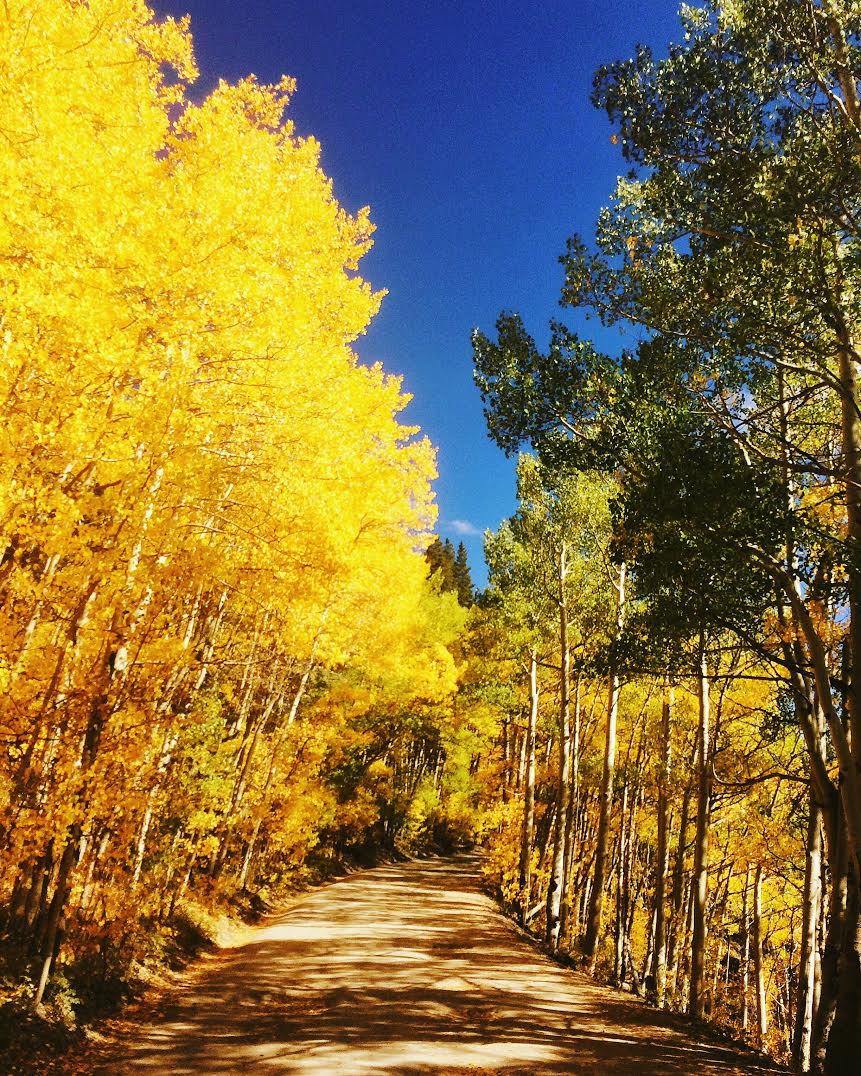
Going to Breckenridge and not going to Boreas Pass is like going to Hawaii and not going to the beach. However, as such, Boreas Pass was the busiest hike I did in Breckenridge. I recommend, therefore, going in the morning or later in the afternoon. You can do like I did, and just meander up and down the dirt-road pass through avenues of brightly colored trees and passed aspen groves, or you can take to one of the trails, most notably Baker’s Tank.
The Baker’s Tank hiking trail begins by the actual tank (of the water variety and not military variety) and winds through the forest, overlooking the valley and the town of Breckenridge. It also sports great views of Tenmile Range, which includes Breckenridge Ski Resort, as well as a number of other tall peaks, including Breckenridge’s own 14er, Quandary Peak, standing at 14,265 feet, and one of the better 14,000-foot Colorado hikes for beginners. (Do your research and be well equipped if considering Quandary. It’s recommended to begin hiking well before sunrise.)
Day 4
Last, but not least was Spruce Creek Trail. I’m going to be honest, however, and just come out and say that I expected this to be the “least” trail, since my expectations were pretty low. I mean how good can the hiking be on a creek trail? Well, evidently pretty damn good. In fact, I’m going to be so bold as to say that it was the best hike in Breckenridge that I went on. There, I said it.
Unlike some of Breckenridge’s best hiking trails that I’ve mentioned here, the Spruce Creek Trail starts close to the elevation of the town of Breckenridge itself. Also, the turnoff to the trailhead is just a couple miles outside of Breckenridge, making it pretty convenient. The first mile or two of the trail was pretty level, weaving through thick forest, around streams, and over logs. It all felt very Rivendell-ish.
And then it really started getting good, when after a mile and a half I saw a mountain biker (what was one of several that I saw), who said to me as he rode past, “Bear to the right at the fork and you’ll see a moose a quarter-mile on the left.” I kept hiking and then stepped dead in my tracks. Did he say a moose? As in a moose-moose? Or is that like Breckenridge talk for something of a really big deer?
Nonetheless, I heeded his advice and took a right at the fork. My eyes were peeled, as I scanned every side of the trail as I continued walking. I had almost resolved to not seeing the moose after 10 minutes, when after turning a corner, I heard something to my left. 10 yards off the trail between a couple bushes, the largest moose I had ever seen was bending its legs to lie down. We then had a staring contest, which he won, in part because of what I think was cheating. You guys, my attention broke because of the loud call of another moose in the distance. I snapped a couple quick photos and then turned around.

From there I took the trail up toward Mohawk Lake, which was the intended destination of my hike. It was at this point that the elevation started to gain. The first proper panoramic view was near the bottom of Continental Falls, where an abandoned cabin (basically a Lincoln Logs replica) stood, overlooking the valley and surrounding peaks beyond Breckenridge. Straight behind me stood Continental Falls, the largest waterfall in Breckenridge.
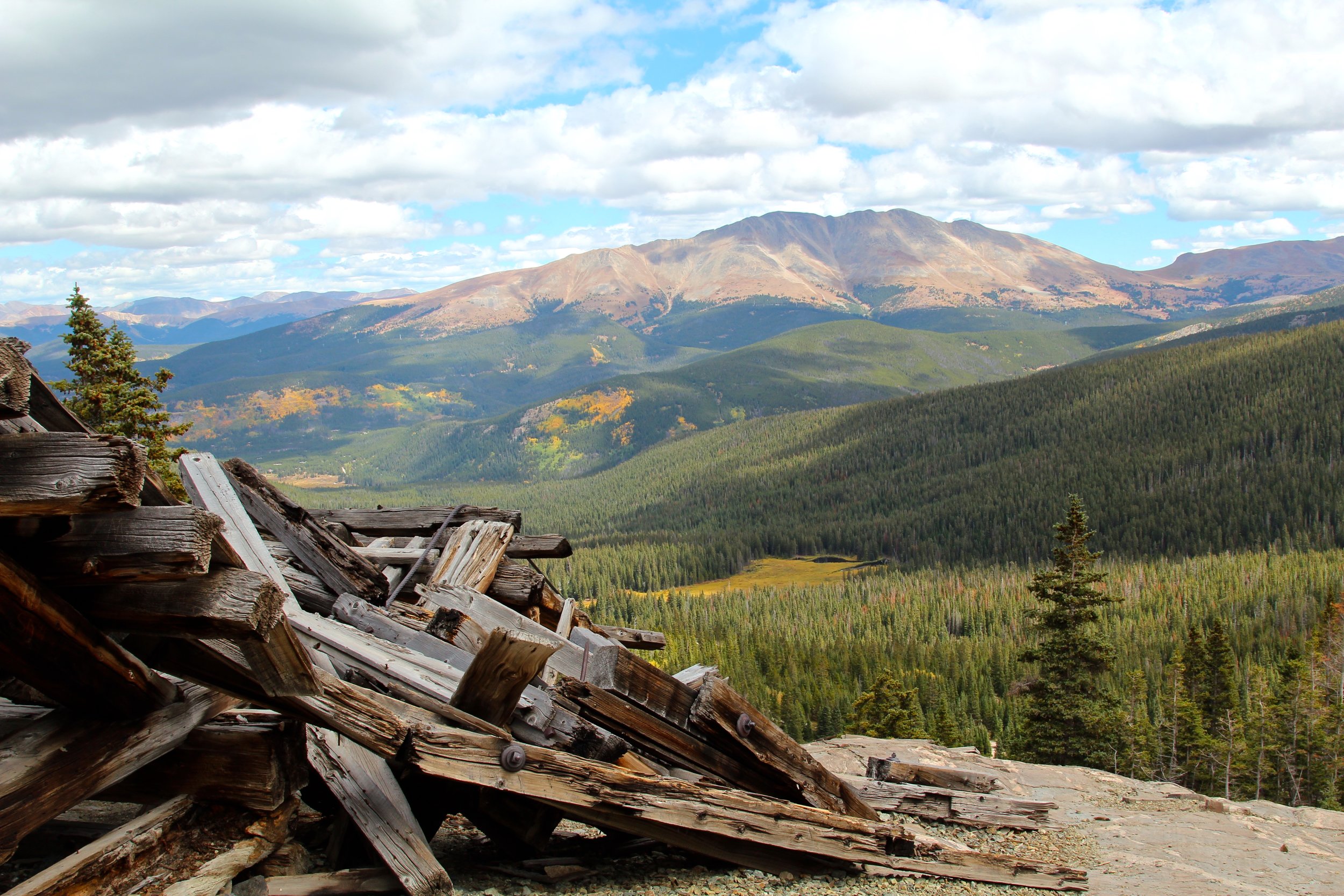
While it’s certainly not the largest waterfall I’ve seen, it was one of the most impressive waterfall hikes I’ve done recently, because every time I thought I was near the top of it, it’d keep going. The reward of the steep switchbacks to the top of Continental Falls is the uninterrupted panoramic overlook, where you’re standing beside mine ruins looking out over mountain peaks and the valley.
But wait, there’s more! That still wasn’t the main attraction at Spruce Creek Trail. The main attraction was Mohawk Lake, which is actually two lakes, Lower Mohawk Lake, just behind the summit of Continental Falls, and Upper Mohawk Lake, which requires additional hiking up higher elevation, and where you’ll often see mountain goats. That’s right; on one hike in Breckenridge, Colorado you could see moose, mountain goats, several lakes, mine ruins, abandoned cabins, and a waterfall. It’s like the Burger King of hikes; have it your way.
However, it should be noted that the entire Spruce Creek Trail hike is a six-mile hike and won’t take less than a few hours to complete. Also, I met several locals who have lived in Breckenridge for many years and had never seen a moose, and these people hike just about every day. So you may be more likely to find a unicorn in a desert than see a moose in Breckenridge.
From my several days of hiking in Breckenridge, Colorado, there were a few things that I learned first-hand, while other things I learned from locals and meeting others are the trail. Hiking Breckenridge, and really Colorado in general, isn’t like hiking anywhere else in America, largely because of the elevation. Thus, I want to impart some of these Breckenridge hiking tips to you:
- Acclimatize. In other words, don’t hike a 13,000-foot mountain on your first day in Colorado. Or do, and call me the next day so I can tell you, “I told you so.” If you live somewhere like the West Coast and have the accessibility, do a higher elevation hike prior both to see how your body responds and to get used to higher elevation. I’m fortunate in Southern California, where just 30 miles from L.A. is Mt. Baldy, a 10,000-foot mountain.
- Hike in the morning. During most of hiking season in Colorado, you can expect afternoon thunderstorms, and you don’t want to be in the wide-open spaces of Colorado’s hiking trails when lightening starts striking.
- Layer up. I saw weather swings of as much as 10-20 degrees in a matter of minutes, when all of a sudden it was sunny and blue skies, and then it was cloudy, windy, and pouring rain.
- Lay out how much water you think you’ll need and then double it. I did this for the Spruce Creek Trail and still didn’t have enough water. In a dry, high-elevation climate like Colorado, water is a premium. So take more than you think you’ll need.